 geo.be Metadata Catalog
Science and technology
Type of resources
Available actions
Topics
INSPIRE themes
federalThemes
Keywords
Contact for the resource
Provided by
Years
Formats
Representation types
Update frequencies
status
Service types
Scale
Resolution
-

This web service provides a download per object of the dataset Cadastral parcels - INSPIRE. . This webservice complies with the INSPIRE specifications.
-
This web service provides a display of the dataset Cadastral parcels - INSPIRE. This webservice complies with the INSPIRE specifications and is available in several formats. It is recommended to use the PNG format.
-

This web service allows viewing the datasets under the Marine Strategy Framework Directive (MSFD).
-

Orthophotos are digital aerial photographs that have been adjusted for lens distortion, topographic relief and camera tilt. This cover is renewed every three years.The orthophotographs have a minimal resolution of 50 cm. The dataset is generated from the harmonisation of the datasets owned by the Belgian administrative regions.The dataset is INSPIRE compliant. The dataset is downloadable per NGI mapsheet at scale 1:50000.
-

This webservice allows viewing a digital surface model. It is a homogeneous and regular points grid which indicates the height above the surface of the earth, either the soil or any other permanent and visible element in the landscape (vegetation, construction,…). These data represent the situation of the landscape resulting from the July 2021 floods in het areas of the Vesdre, of part of the Meuse downstream from Liège and of the Demer. The heights are given relative to the Belgian zero level (fictitious zero of Uccle). The data have a resolution (size of the meshes of the regular grid) of 20 cm.
-

MapIndex is a regular grid of rectangular or square cells coded with alphanumeric characters. It has been defined for the Belgian territory and allows geolacating several events. The present version is a beta (v2)version which is submitted to the emergency services. It will evolve to a standard cartographic grid.
-
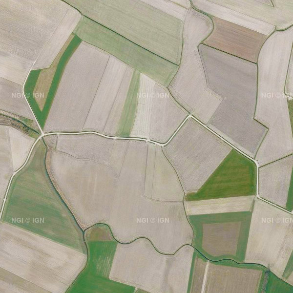
This service allows the visualization of a mosaic of orthophotos made for the whole Belgian territory. Access is possible through either a Web Map Service (WMS) or a Web Map Tile Service (WMTS, more powerful). Orthophotos are digital aerial photographs that have been adjusted for lens distortion, topography and camera tilt. The orthophotographs are metrically more accurate than common aerial photographs. They are very valuable as reference information and also, for instance, for surveying parcels. The orthophotographs mosaic is created based on digital, colour aerial photographs acquired by the Belgian Regions. It is georeferenced in the Lambert2008 coordinates system. This cover is renewed every year. The orthophotographs have a minimal resolution of 25 cm.
-
Mapindex is a WMS which allows viewing the regular index grid which has been defined on five levels for the entire Belgian territory. It has been defined in order to allow a zonal geolocation. The present version is a beta version (v2) which is submitted to the emergency services. It will evolve to a standard cartographic grid.
-
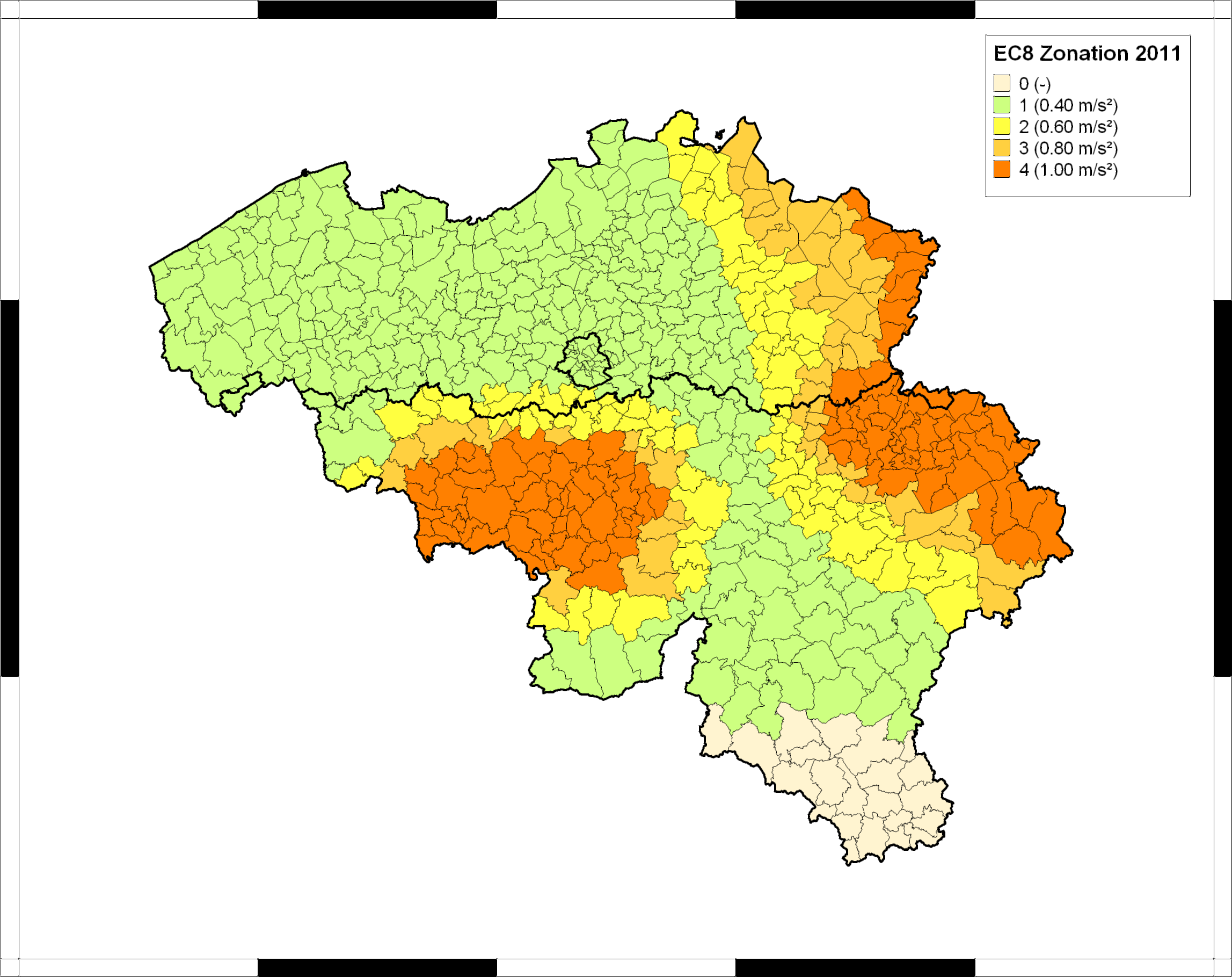
The seismic zoning map for Belgium was published in the Belgian national annex (NBN EN 1998-1 ANB) to the European building code Eurocode 8 (EN 1998-1), which became effective in all European member states in 2011. This map classifies Belgian communes into five seismic zones, corresponding to different values of the reference peak ground acceleration (PGA) to be taken into account in the design of structures for earthquake resistance. In combination with the importance class of the building and the ground type, the reference PGA is used to calculate the design response spectrum defining the accelerations that the structure should be able to withstand without collapse. For further details and the precise specifications, users should consult the normative documents, which can be ordered from the Bureau for Standardisation NBN (https://www.nbn.be/en). The Eurocode-8 seismic zoning map for Belgium was established by the Royal Observatory of Belgium, based on a reimplementation of the seismic hazard map of Leynaud et al. (2000) for a return period of 475 years (equivalent to 10% probability of exceedance in a timespan of 50 years). This hazard map was calculated following the principles of probabilistic seismic hazard assessment, and based on a simple model of seismic sources and their activity in and around Belgium, and a single ground-motion model (or “attenuation law”), describing PGA in function of earthquake magnitude and epicentral distance. To date, this is the only seismic hazard map that has been published specifically for Belgium, and it is still considered as the official seismic hazard map for Belgium.
-
This dataset shows a digital surface model. It is a homogeneous and regular points grid which indicates the height above the surface of the earth, either the soil or any other permanent and visible element in the landscape (vegetation, construction,…). These data represent the situation of the landscape resulting from the July 2021 floods in het areas of the Vesdre, of part of the Meuse downstream from Liège and of the Demer.